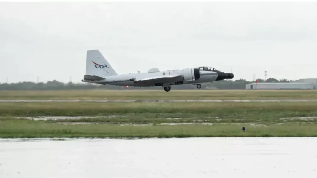
In the face of natural disasters, every second counts. The ability to quickly assess the situation and provide aid to those in need can make all the difference. That’s why when severe flooding hit Kerrville, Texas, NASA sprang into action. The agency deployed two aircraft equipped with cutting-edge technology to assist in search, rescue, and recovery efforts. The result? A powerful combination of DyNAMITE and UAVSAR sensors that delivered real-time, high-resolution imagery and radar data to aid FEMA and local authorities.
The flooding in Kerrville, Texas, was devastating. The heavy rainfall caused rivers to overflow, roads to become impassable, and homes to be submerged. The situation was dire, and the need for assistance was urgent. That’s when NASA stepped in. The agency, known for its groundbreaking work in space exploration, has also been at the forefront of disaster response efforts. And this time was no different.
NASA’s DyNAMITE (Dynamic Navigation, Avionics, and Mission Integration Technology Experiment) is a state-of-the-art sensor system that provides real-time, high-resolution imagery. It is mounted on a NASA Gulfstream III aircraft, which can fly at high altitudes and cover large areas quickly. The DyNAMITE system uses a combination of infrared and visible light cameras to capture images of the affected areas. These images are then transmitted in real-time to a ground station, where they are analyzed and processed.
But that’s not all. NASA also deployed its Uninhabited Aerial Vehicle Synthetic Aperture Radar (UAVSAR) system. This advanced radar technology is mounted on a NASA C-20A aircraft and can provide high-resolution radar data of the affected areas. The UAVSAR system uses a technique called interferometry, which allows it to create detailed maps of the terrain, even through clouds and vegetation. This data is also transmitted in real-time to a ground station, where it is processed and made available to FEMA and local authorities.
The combination of DyNAMITE and UAVSAR proved to be a game-changer in the search, rescue, and recovery operations in Kerrville. The real-time imagery and radar data provided by these systems allowed FEMA and local authorities to quickly assess the situation and identify areas that needed immediate attention. This information was crucial in directing rescue teams to the most affected areas and helping them navigate through the flooded terrain.
Moreover, the high-resolution imagery and radar data provided by DyNAMITE and UAVSAR helped authorities identify potential hazards, such as damaged infrastructure and blocked roads. This information was crucial in ensuring the safety of rescue teams and preventing further damage to the affected areas.
The use of these advanced technologies also helped in the recovery efforts. The detailed maps created by UAVSAR allowed authorities to assess the extent of the damage and plan for the reconstruction of the affected areas. The real-time imagery provided by DyNAMITE also helped in monitoring the progress of the recovery efforts and identifying any new hazards that may have arisen.
The deployment of DyNAMITE and UAVSAR by NASA in response to the severe flooding in Kerrville, Texas, is a testament to the agency’s commitment to using its expertise and resources for the betterment of humanity. The use of these cutting-edge technologies not only aided in the search, rescue, and recovery operations but also helped in minimizing the impact of the disaster and saving lives.
In addition to its disaster response efforts, NASA’s work in developing and deploying advanced technologies has numerous other applications. These technologies can be used in various fields, such as agriculture, environmental monitoring, and infrastructure management. The agency’s commitment to innovation and its ability to adapt its technologies for different purposes make it a valuable asset in times of crisis.
In conclusion, the deployment of DyNAMITE and UAVSAR by NASA in response to the severe flooding in Kerrville, Texas, is a shining example of how technology can be used for the greater good. The real-time, high-resolution imagery and radar data provided by these systems proved to be invaluable in the search, rescue, and recovery operations. It is a testament to the agency’s dedication to using its resources for the betterment of humanity and its ability to rise to the occasion in times of need.


