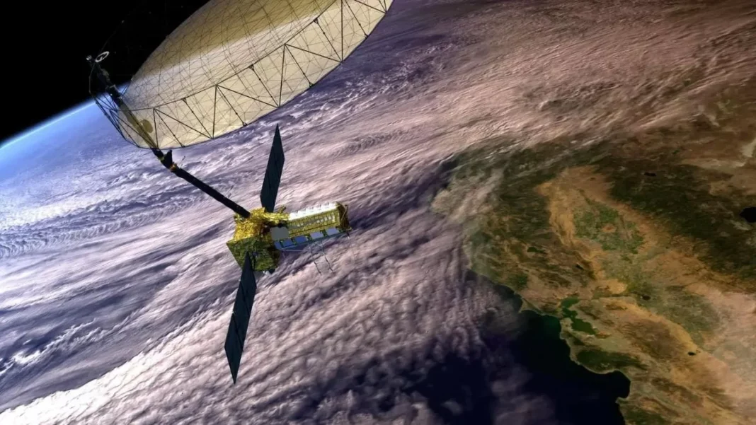
NASA and India’s ISRO (Indian Space Research Organisation) are joining forces to launch a groundbreaking satellite, NISAR (NASA-ISRO Synthetic Aperture Radar), which will revolutionize Earth observation technology. Equipped with advanced dual-band radar, NISAR is set to lift off no earlier than late July 2025 from Sriharikota, India, and will mark a significant milestone in the collaboration between these two space agencies.
The NISAR mission is a result of a partnership between NASA and ISRO, with both agencies contributing expertise, technology, and resources. This collaboration showcases the growing trend of international cooperation in space exploration, as countries come together to tackle global challenges and push the boundaries of scientific research.
NISAR will be the first satellite of its kind to use advanced dual-band radar to map nearly all of Earth’s land and ice every 12 days, capturing surface changes with centimeter-level precision. This will provide valuable data for a wide range of applications, including disaster management, climate monitoring, and natural resource mapping.
The satellite will carry two radar systems, the L-band radar developed by NASA and the S-band radar developed by ISRO. The L-band radar will provide a wide coverage of the Earth’s surface, while the S-band radar will offer high-resolution images of smaller areas. Together, these radars will provide a comprehensive view of our planet, enabling scientists to study changes in the Earth’s surface with unparalleled accuracy.
One of the key objectives of the NISAR mission is to monitor and track changes in Earth’s surface over time. This will help scientists better understand the effects of climate change, natural disasters, and human activities on the planet. With its advanced radar technology, NISAR will be able to detect even the slightest changes in the Earth’s surface, providing crucial data for researchers to analyze and interpret.
NISAR will also play a crucial role in disaster management and mitigation efforts. By providing real-time images and data, the satellite will aid in assessing the impact of natural disasters such as floods, earthquakes, and landslides. This will help authorities make informed decisions and take timely action to minimize the damage and save lives.
Moreover, the satellite’s ability to map land and ice every 12 days will be a game-changer for agriculture and natural resource management. NISAR will provide detailed information on soil moisture, crop growth, and water availability, which will be invaluable for farmers and policymakers. It will also aid in the management of forests, water resources, and coastal areas, helping to preserve and sustain our planet’s natural resources.
The launch of NISAR is a significant step towards strengthening the cooperation between NASA and ISRO. This mission not only showcases the technical capabilities of both agencies but also highlights the mutual trust and understanding between them. This partnership has already seen successful collaborations, including the Mars Orbiter Mission (MOM) and the Chandrayaan-2 mission, and NISAR is another milestone in this fruitful relationship.
The satellite will be launched aboard ISRO’s GSLV Mk II rocket from the Satish Dhawan Space Centre in Sriharikota, India. The launch site was chosen due to its proximity to the equator, which allows for a more efficient launch. The satellite will be placed in a polar orbit, which will enable it to cover the entire Earth’s surface.
The NISAR mission is a testament to the power of international collaboration in space exploration. By combining resources and expertise, NASA and ISRO are pushing the boundaries of scientific research and paving the way for future missions. This mission will not only benefit the scientific community but also the global population, as the data gathered by NISAR will help us better understand and protect our planet.
In conclusion, the launch of NISAR is a highly anticipated event that will mark a significant milestone in the collaboration between NASA and ISRO. With its advanced dual-band radar technology, the satellite will provide invaluable data for a wide range of applications, including disaster management, climate monitoring, and natural resource mapping. This mission is a testament to the power of international cooperation and the determination of these two space agencies to push the boundaries of scientific research. The launch of NISAR in late July 2025 will be an exciting moment for the global scientific community and a step towards a better understanding of our planet.


